

Here I sit in my WARM home office doing some reflecting. I am not only doing this because of the season but of the other forces that have effected my family, friends and neighbors in recent days.
Where I live, Fort Wayne, Indiana experienced a bad winter storm of snow, ice, and bitter single digit temperatures. A result of that wicked combination was over 100k households in the span of about 3 hours lost power on Friday 12/19/08. My house was one of them. I was not worried. I am prepared. I have a disaster plan and supplies, but I was in a world of hurt. The problem was that with any disaster is that most people DO NOT prepare, and thus the problems begin. With this storm, the bitter cold was the enemy. I had hooked up "Mr Grumpy" my 6800k generator, to keep the furnace and basics working. I also rigged up my neighbors furnace and had their house covered too. All around me was darkness, for 30 blocks in every direction, I had a serious concern about theft and looting. I have no worries in that dept. either, I am armed. Since most of my neighbors had left and knew I was staying, they ask me to look over their houses.
To keep my sanity, I kept a routine, fire roaring, lights off, and every two hours make the rounds of the ten or so houses around me and of course check "Mr. Grumpy". Between rounds, a little shut eye, catching up on reading ( with my led headlamp) and stoking the fire. The storm had also dropped a large amount of tree limbs across roads, over cars and on houses. The sound of all the ice and wind was the most unique sound I have ever experienced. On day 3 I really got worried, most stores were out of supplies, and the gas station nearest to me lost power. I did have 18 gallons in reserve, but in this instance, I had 3 extra gas cans and so I ventured out to fill them. (a four hour venture). OK, so on top of all this, I had to go check on my Alzheimer's mother and her facility. All good there, they actually had a primary and secondary generator and had not lost power. In addition, I am watching over my 98 year old Great Aunt Clara. A few problems there, the "Independent Living" facility where she lives was dark. Apparently, state code does not require them to have back-up power. Needless to say. I gave them a bitching out after discovering the lack of generators. I tried to get them to describe to me what the difference is between profits and doing the right thing is. I made arrangements to get my great aunt to a relatives house with power.
Enough of my long and boring story, lets jump to today. Power is restored and everyone is back where they belong in my family. Others are not so lucky. As of this writing, approx. 17k homes still have no power. A note on the Power Company. American Electric Power took a shotgun blast on this weather event. Their response was nothing more than heroic. They have done an outstanding job, bringing in crews totaling 1300. I personally saw over a dozen different convoys of trucks and charter buses of crews. On the second day, at a staging area, they must have had 300 trucks gathered in a Wal-Mart store parking lot. I saw that and knew the Calvary had arrived! I saw trucks from North Carolina and Tennessee. They have gone beyond the duty to work around the clock to get the power restored. One thing I failed to mention are the 35+ mph winds after the storm. This posed a dangerous threat to the crews trying to work outside and a threat to tearing down the repairs already done. I cannot say enough for these workers, they really saved the day!
Think about how you will prepare for 2009, think about how you will handle the adversity, think about how important your family is and what they mean to you. If you are prepared, you can handle anything...
Merry Christmas to all-May Christ warm your heart with his love.
StormCam! Headlines for your site or blog. Keep up with the latest updates without doing a thing!
Tuesday, December 23, 2008
A World of Hurt
Tuesday, December 02, 2008
A Sweet New Post

Here is another post from me. I know, you don't have to say a word. I am very pathetic on keeping the blog updated BUT I am trying to change my ways!
The Climate Prediction Center has released its revised forecasts for December 2008
It seems as we might on the run for a colder than normal December...
Saturday, October 04, 2008
The subtle art of nothing
I really like doing a blog BUT I seem to always forget...I really like the phone in ability with Jott but still I have to actually do phone-in to update. So as promised, I will try to keep things neat and tidy here! I moderate the comments, so if you make fun of my shoes or mother I probably wont let your comment be seen.
Hope you all have a great fall
Monday, June 16, 2008
Yes, Billy, I am still around. I have not been updating this site as much as I should, I do apologize to all the thousands of fans. Right. Doubt that. I have actually been busy chasing. I was out in the the plains over memorial weekend and captured some amazing footage. I found the time to detour to Grennsburg, Ks to see it a year after the EF5 struck. I was stunned at the amount of damage and scarring, even after a year of rebuilding efforts. My heart goes out to all of the Greensburg, KS residents who are facing the task of starting over.
Seems as tho the summer is upon us, hope you have a good one.
Thursday, May 01, 2008
Well, today looks like...
Powered by Jott
Monday, April 28, 2008
Yes To All-I am still Alive!
Very sorry for the lack of posts, slightly busy at the moment. And for the few PM's got, yes I do have a lot of crap on here, I have been testing a few different html tags, scripts and app's recently. Post a comment on them and let me know what you think.
I just got all my "geeky" weather stuff put on the chasemobile, I'll try to post a few pics.
Weather seems to be breaking into more typical patterns recently, so I EXPECT chases to for me to happen soon. To be honest, many of us in the chase community are concerned about the cost of gas and how it will effect us. I think you will see the parameters tighten for many and see less slight chance chases vs moderate to high risk chases. keep checking back for LIVE video links.
Finally, a shout out to my buddies on cybernations.net . This is a fun on-line game that involves simulations of nations. I hit it hard and have a bunch of buddies that do too.
Wednesday, April 09, 2008
April 10 and 11

 Images from theweatherboard.com
From the SPC:
 This kid of pattern gets us chasers fired up. Some selected dialog from the Storm Prediction Center:
***A SEVERE WEATHER OUTBREAK IS EXPECTED ACROSS PORTIONS OF THE
  MID-MS VLY AND MID-SOUTH THU AFTN/EVE.  TORNADOES...INCLUDING A FEW
  LONG-TRACKED STRONG VARIETY...VERY LARGE HAIL AND DAMAGING WINDS CAN
  BE EXPECTED.

A MULTI-MODE SVR DAY IS LIKELY ON THU IN AND NEAR THE
  MDT RISK AREA. STRONG/SVR TSTMS WILL BE LIKELY ONGOING THU MORNING
  ACROSS PORTIONS OF CNTRL/ERN OK AND N TX NEWD INTO MO...KS AND AR.
  DOWNSTREAM FROM THIS ACTIVITY...GULF MOISTURE WILL ADVECT NWD...AND
  BY THU AFTN...60-65F SFC DEW POINTS WILL PROBABLY BE IN PLACE AS FAR
  N AS SERN IA AND CNTRL PARTS OF IL/IN.  AS THE BOUNDARY LAYER WARMS
  AND EFFECTIVELY WEAKENS THE CINH...SFC-BASED QUASI-DISCRETE
  SUPERCELLS ARE LIKELY TO EVOLVE...EITHER WITHIN/ NEARBY REMANENT
  MORNING ACTIVITY...OR SEPARATELY ALONG/AHEAD OF THE COLD FRONT.
  GIVEN THE STRENGTH OF THE SLY FLOW...RAPID DESTABILIZATION WILL
  PROBABLY OCCUR WELL NWD INTO MO...IL AND IN.  BUT...THE IMPACTS OF
  EARLY DAY ACTIVITY REMAIN UNCERTAIN... ESPECIALLY WITH NWD EXTENT OF
  THE OTLK AREA.  NONETHELESS...VERY STRONG KINEMATICS/FLOW FIELDS
  WILL LEAD TO A MARKED SVR RISK EVEN WHERE MODEST MLCAPE MATERIALIZES
  IN WAKE OF THE WARM FRONT.
The full discussion is here http://www.spc.noaa.gov/products/outlook/day2otlk.html
I am not sure if I will be out chasing on this as it seems as if the severe weather will be farther south, but depending on the next update and the wording within it, I might change my mind.
Friday, March 21, 2008
Yes It's true!
 Well, I hate to post this, but it true! From the NWS Northern Indiana "An area of low pressure will track through central Indiana Friday afternoon into Friday night. Heavy wet snow will be possible to the north of this system...mainly for areas along and north of Highway 6. Lesser amounts are expected near Highway 30 as the snow will mix with rain at times. Less than an inch is expected to the south with the bulk of the precipitation forecast to fall as rain. Snowfall totals expected late Friday morning through Saturday morning are shown in the graphic above."
I thought for sure we were done with wnter. Let's hope Easter is snow free!
Thursday, February 28, 2008
Busy Again
I have running since I returned fromChaserCon! Some weather grumblings will come fourth once I can get some real sit-down time. Hope all is well for my regulars and keep checking back often!
When I took the kids to school this morning, it was ZERO...I know spring will be here soon...
Sunday, February 17, 2008
Head East Young Man!
We are on are way home! We had a great time. A Special shout out to the Severe Studios team. Kory and Kenny have a great site and a fantastic group of chasers. I highly recommend visiting their site: severestudios
Now on to the task at hand, 17 hours of road in front of us. Wish us luck!
Saturday, February 16, 2008
Live Updates from 2008 Chasercon
I will be trying to give semi-live updates from the 2008 National Storm Chasing Convention. With over 250 attendees including some from other countries, this year seems to be the best ever! I have met many people and look foreward to giving you all the best timely updates I can.
SATURDAY
8:31 am Jon Davies is giving his presentation: Chase Forecasting Mistakes and Lessons
jon is speaking about the Greensburg, KS event
Jon is giving some great examples of wx events!
9:07am Mike Umscheid begins his presentation: Forecasting the Greensburg, KS Tornado
Mike was on duty and the forcaster who was working and I think is the one who posted the warnings for KS that day. His presentation is graphic in that the EF5 tornado was the most active and strongest weather day he has seen.
Some quick facts about the "mighty four" KS day
greensburg EF5 was active for 65 minutes, 28 miles ground track, 11 fatalities and caused an estimated 250 million in damage.
10:37 am Tim Marshall begins his presentation: 2007 Chase Cases
Tim is very funny and is presenting details and forecasts from the 2007 season. Tim's insight and engineering background are a great combo, his presentations are always entertaining!
a Wilford Brimley reference from Tim gets the crowd laughing
Tim once again has done it! a great presentation... Here is the summary of a what makes a strong chase stategy:
1. Make critical decisions by 2 pm each day. set target area, etc...
2. Sometimes the TA need to be stayed with, sometimes not!
3. Most importantly, Be prepared for the unexpected!
11:28 am Tim Samaras begins his presentation: High Speed Photography of a Naturally Produced Lightning Strike
He is working on a highly technical set-up for the high-speed capture of lightning strikes. He showed a number of images that show this technique. The camera is the highest speed and best resolution camera in the world. His level of understanding of this is fantastic, way beyond what my level of understanding...
1:27 pm Dr. Sandy MacDonald begins his presentation: Ideas for an Operational Short Range Weather Prediction System in 2020
He poses a question for us all: What is the difference between an eye of a Supercell and the eye of a Hurricane?
Anyone know the answer? PM me on stormtrack.org-if you get it right, I'll post your name here.
Sandy spoke about the Phased Array Radar System that is being tested and will be implemented... when I get the link to the project demo site, I'll post it here.
2:09 pm David Hoadley begins his presentaion is titled: On The Way To The Storm
Gave details and the brief history of the area thats makes up the tornado alley area.
3:00pm Dr. Josh Wurman begins his presentation: Update on Vortex2 project
Four points, Dr. Wurman says VORTEX2 will seek to answer a few questions :
1. Tornadogenesis
2. Near-ground wind field in proximity of a tornado
3. Relationship between storms and the environment
4. Storm scale numerical weather prediction
More Info on the Vortex2
3:30 pm Roger Hill begins his presentation International Typhoon Chasing
Roger documents his chase of Super Typhoon Krosa
4:07 pm Dr. Howard Bluestein begins his presentation: Highlight from the 2007 Storm Season: The Greensburg, KS Tornado and the MWR-05XP
A picture of the MWR-05XP
Ok, Day 1 presentations are over...Keynotes tonight from Dr. Josh Wurman and Sean Casey-this should be something as both are very dynamic.
I'll post some thoughts tonight after, I hope:)
I hope you have enjoyed my limited ramblings as I was trying to type and listen at the same time. I have enough problems doing each of those by itself!
I have met so many people here... after all having over 250 of the top performers in our field in one spot is quite a convergence! Many conversations, lots of new friends...
Tomorrow, will be just as exciting...stay tuned
SUNDAY
8:15 am Mike Umscheid begins his presentation: Digital Photography Techniques
Mike suggests these sites to use as good internet reference sites:
http://www.luminous-landscape.com/
http://www.photosig.com/go/main;jsessionid=amIVmdNh0fHbUk2aOG
http://www.betterphoto.com/home.asp
Some tips offered by Mike:
-Use a tripod!
-If shooting storms, use f8 and stay there!
-Shutter speeds should range between 1/2 and 5 seconds
When it gets darker, keep increasing the ISO up to 800. Above that, you will start to get motion blur.
Mike gave some great tips on ow to shoot photos of storms, if you are interested in shooting lightning, consider looking at this site: lightningtrigger.com
It is a device you attach to your camera that helps to trigger the camera when a strike happens.
9:25 am Jon Davies begins his presentation: Forecasting for Non-Supercell Tornados
Jon once again gives a great insight on gustnados, land spouts and QLCS squall line tornado's. Since I live in Indiana, this topic was of great interest.
10:30am David Hoadley begins his presentation: Forecasting Severe Storms from surface
Data
As soon as time permits, I'll give you all some thoughts on the 2008 convention. Thanks to all for their messages and comments.
Friday, February 15, 2008
Hello everyone, we are...
Powered by Jott
Monday, February 11, 2008
New Equipment

A remote posting by Jott
Powered by Jott
Saturday, February 09, 2008
120 miles
From the NWS Little Rock, AR
Damage reports suggest that the tornado was rated at a EF4 with a ground track of 120 miles! It is believed to be one tornado that did this as the NWS field assessment teams noted this from their observations of the continuous lines of destruction.
The line of storms were extremely powerful and damaging, this image from the Little Rock, NWS shows the line of storms:
 (graphic from NWS, Little Rock, Arkansas)
johanthan
2008 Storm Season
Well, the season has begun with a unfortunate flair. The southern outbreak was tragic as many people were injured and some lost their lives. Many Chasers, myself included hope that our documenting and assisting in reporting severe weather events can avert this type of damage. The hope is that our reports and sightings will assist the forecasters in some small way of expanding their warning windows for the general public.
As it is especially important this year, and every year at about this time, we as storm chasers start to look at what type of season it may play out to be. For you that read my blog on a regular basis, you know that I am not a trained forecaster nor am I a meteorologist.. I simply use my passion and expertise as a hobby to provide some insight to weather events. with that being said, here is some fine reading concerning the 2008 storm season:
From the International Research for Climate and Society. This shows a number of models combined to predict a increase in severe wx for 2008. If you want to see specifics and details from the report, please visit the their site at:
http://iri.columbia.edu/climate/ENSO/currentinfo/SST_table.html
From the site, if you don't like a wall of words:
"The set of dynamical and statistical model forecasts issued during late December 2007 and early January 2008 are in agreement regarding La Nina conditions over the next couple seasons. The predictions of possible sea surface temperature conditions in the central/eastern equatorial Pacific, begin with moderate to strong La Nina conditions that gradually weaken through the first few months of 2008. The majority of models indicate a return to ENSO-neutral conditions by mid-to-late 2008. At the time of preparing this, the SST observations in the NINO3.4 region are below their average value, with an area-averaged weekly anomaly of -1.7 C. Tropical Pacific oceanic and atmospheric conditions suggest moderate La Nina conditions are likely through early 2008."
And from the Storm Prediction Center:
http://www.spc.noaa.gov/climo/torn/monthlytornstats.html
This chart only goes back to 2005, it also includes the 10 year average. I know its early, but it looks as if we might have another season like 1999. But who knows!
We will see what the 2008 season turns out to be... Our plan is to be out for more chases and miles than ever before for this season. We are trying to refine and gain the experience to better predict our target areas. This winter we are trying out new technology that will help us better to see what we need to see, in addition, we plan on providing live video and data from the field. This is most exciting for us, as we might allow others to start to experience what its like to chase storms.
Wish us luck and keep checking back! Tell others about our blog! If you are so inclined, feel free to subscribe to the RSS feed, I even made a widget for you to add to your site.
Regards, Johnathan Brouwer
Wednesday, February 06, 2008
The Southern Tornado Outbreak
The link above is a unique perspective from a person who is a chaser that experienced the storms first hand. This posting is taken from stormtrack.org
The Chasers name is Heidi Farrar and she lives in Izard Co., Arkansas She gives a unique report along with pictures.
Friday, February 01, 2008
Another Video Test
Here is a stream I'm testing...click on the above link to see the stream.
It has an embedded chat window that I will be tweaking later today. This is basically a Shockwave window. Soon I will be adding:
Live Chat
Video tags
Location Banner
Weather Stats
Let me know what you think!
Side Note: Thanks to Mitch Harper for mentioning me in his blog Fort Wayne Observed
Welcome to all visitors from there!
220...221 Whatever it takes...
I am NOT a meteorologist. I am a weather enthusiast. I enjoy the weather, always have. I enjoy weather and all the trimmings! I try to always cite my sources from images and articles. My blog relates mostly to severe weather, however, I post what I feel is relevant and important, so what appears here can vary.
As the weather changes and the winter moves into spring, I will be posting much more frequently, so keep checking back!
Thanks for stopping by!
Thursday, January 31, 2008
Here it comes...
 (click on picture to open in new window)
TO 7 PM EST FRIDAY.
SNOW WILL OVERSPREAD THE AREA FROM SOUTHWEST TO NORTHEAST LATER THIS
EVENING...BECOMING HEAVY BY LATE EVENING AND CONTINUE THROUGH FRIDAY
AFTERNOON. INCREASING EAST TO NORTHEAST WINDS WILL LEAD TO
WIDESPREAD BLOWING AND DRIFTING AFTER MIDNIGHT AND HAMPER TRAVEL.
SNOW ACCUMULATIONS OF 6 TO 10 INCHES IS EXPECTED BY FRIDAY
EVENING.
A WINTER STORM WARNING MEANS SIGNIFICANT AMOUNTS OF SNOW...
SLEET...AND ICE ARE EXPECTED. STRONG WINDS ARE ALSO EXPECTED. THIS
WILL MAKE TRAVEL VERY HAZARDOUS OR IMPOSSIBLE.
 (click on map to open in new window)
Tuesday, January 29, 2008
My backyard in January

Here is my backyard in January, not a good sight...Actually I have a number of bird feeders that help keep the little birdies happy all winter.
Mobile Blogging

Well, here is my first mobile blog post! I am working on this so that I can get images from the chase posted onto my blog. My son Gareth took this of me in my office. Using the mobile service from blogger seems easy...I'll be posting a number of test shot over the next few days.
Wish me luck
Wednesday, January 23, 2008
Central Plains Weather Symposium
This years theme will focus on the severe weather climatology of the central plains. A family-friendly educational event, there will be chances for the public to interact with the featured speakers, video, hands-on experiments for kids and much more. Come and learn about the science around Severe Weather.
The event will run all day from 9 a.m. to 5 p.m. at the newly renovated Hardin Hall, home to the School of Natural Resources, University of Nebraska - Lincoln.
I am planning this as a trip for spring break for my kids. Check out the link for more details.
Central Plains Weather Syposium
Saturday, January 19, 2008
Pay Attention, the NWS has issued a wind chill advisory for INDIANA!


"WIND CHILL TEMPERATURES ARE EXPECTED TO FALL TO BETWEEN 20 BELOW
TO 25 BELOW ZERO TONIGHT INTO SUNDAY MORNING.

A WIND CHILL ADVISORY MEANS THAT VERY COLD AIR AND STRONG WINDS
WILL COMBINE TO GENERATE LOW WIND CHILLS. THIS WILL RESULT IN
FROST BITE AND LEAD TO HYPOTHERMIA IF PRECAUTIONS ARE NOT TAKEN.
IF YOU MUST VENTURE OUTDOORS...MAKE SURE YOU WEAR A HAT AND
GLOVES AND COVER EXPOSED SKIN."

1040 AM EST SAT JAN 19 2008

...WIND CHILL ADVISORY IN EFFECT FROM 7 PM THIS EVENING TO 10 AM EST
SUNDAY...

REST OF TODAY...SUNNY LATE IN THE MORNING THEN BECOMING PARTLY
SUNNY. A 40 PERCENT CHANCE OF SNOW SHOWERS IN THE AFTERNOON. COLDER.
HIGHS 10 TO 15. TEMPERATURE STEADY OR SLOWLY FALLING IN THE
AFTERNOON. WEST WINDS 15 TO 20 MPH WITH GUSTS UP TO 30 MPH. WIND
CHILLS 4 BELOW TO 14 BELOW ZERO.

TONIGHT...MOSTLY CLOUDY WITH SCATTERED SNOW SHOWERS. COLDER. LOWS
NEAR ZERO. WEST WINDS 10 TO 15 MPH. CHANCE OF PRECIPITATION
30 PERCENT. WIND CHILLS 10 BELOW TO 20 BELOW ZERO.

SUNDAY...MOSTLY CLOUDY. HIGHS AROUND 10. WEST WINDS 5 TO 10 MPH.
WIND CHILLS 11 BELOW TO 21 BELOW ZERO IN THE MORNING.
Thursday, January 17, 2008

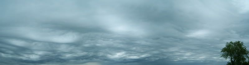
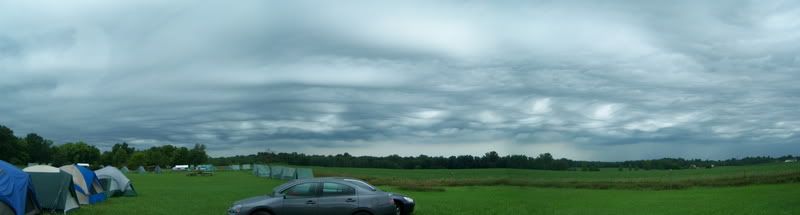
June 2007 Camp Chief Little Turtle, Ashley, Indiana
I promised a brief explanation of what INCHASE is/was is going to become...
Indiana Chasers of Adverse and Severe wEather was started a number of years ago in Indianapolis by a number of weather enthusiasts was were disillusioned with the rising amount of reckless chasing. They wanted to chase severe wx but in a responsible way. The early days saw a lot of activity, meetings, group chases and even other groups such as: ILCHASE, MICHASE and OHCHASE...
Jump forward a couple of years, the group got less active, people moved on, so in stepped my current chase partner and myself. We liked the concept, and so we adopted it with the blessing of the past group and are currently working at resurrected it. Unfortunately, the URL has lapsed, and has been acquired (not by us) and so another group is reborn!
Clay Stahlka and myself have been working the last few seasons to get ourselves experienced and able to chase with confidence. We have a new site in the works and have been working on getting people involved again. We are doing this because we love weather, we love to chase and in doing so we if we can help the NWS and the public with our efforts, then we have accomplished what we wanted to.
I will give more details about our chase strategy, the tools and our chase vehicle.
Keep stopping by, as I will be adding more material each day.
Regards, Johnathan Brouwer
Monday, January 14, 2008
The National Storm Chaser Convention
I have updated the blog with the The National Storm Chaser Convention link to the right... The gathering allows chasers the opportunity to gather, listen, learn and to network. Many well known speakers will be presenting, including:
-Dr Greg Forbes from The Weather Channel
-Dr Josh Wurman and Sean Casey as the keynote. (Rumor has it that the New TIVII will be there too!)
-Dr Howie Bluestein
-David Hoadley
-Tim Marshall
-Tim Samaras
-Jon Davies
-Mike Umscheid
I think there are others that have not officially committed, so this list could grow. Please check out the link to the right to go directly to the Convention site.
Hope to see ya there!
More on me

I am not a well known chaser.
I have preferred up to this point to lay low and bring myself up slowly. I know that sounds stupid, but why rush things right? Each season, myself and the others at INCHASE (more on them later) have set specific goals and milestones to achieve. "Working the weather" and using the data to drive your chase is extremely difficult and even if the data tells you one thing, sometimes the other thing happens. I have the highest level of respect for our NWS meteorologists, my fellow highly experienced chasers and enthusiasts. As I said, each season since 2004, we have set goals. One was to better understand the the predictors and initiators for storms. In doing this, we busted a lot for our target areas. We learned and have refined that skill. Another goal was to get better at removing our faces from our laptops and using the signs around us once we are close. Not doing that can get you in trouble. Overall, my personal goal was to experiment and use the technology from my professional life and bring it to the storm chasing table. In my Real life, I am a media producer. I get paid to come up with ideas and figure out the best way to implement them. Sound like fun? It is. I have produced commercials, feature films, corporate video and for the last 8 years I have worked on long-form documentaries. I have brought most of my cameras with me on chases. I got some great footage and some really bad footage too! I also brought my technology along. My wife calls our chase van the rolling geekmobile...I call it my home for many hours of driving and spotting. We use the spotter network, GPS, Skype, Yahoo IM and live video to report our position. We feel we have a fairly good system put together. We really look forward to 2008 as we have blocked our schedule for a number of days out on the plains. I will do my best to post more on myself and my geekdom. Stay tune!
Up next: The National Storm Chaser Convention is fast approaching.
After That: The INCHASE Group


